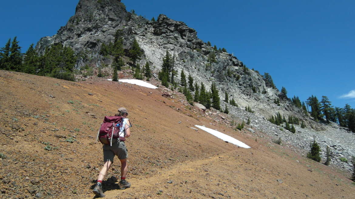
When someone at Crater Lake National Park says, “Take a hike!” it’s not some negative. At Crater Lake it’s good advice. Deciding where to hike can be challenging. If I’m asked where to take a hike, my answer is usually the hike I took most recently.
Most of the favorites involve viewing the lake. While views from any of the overlooks along Rim Drive or at Rim Village, are entrancing, there are other ways to experience the lake and the park. Seeing the lake is a must. But whether it’s a first visit or the umpteenth, for a different perspective consider taking a hike. For repeat visitors, select a hike you’ve never taken, or haven’t taken for years, and transform a routine Crater Lake visit into a great day.
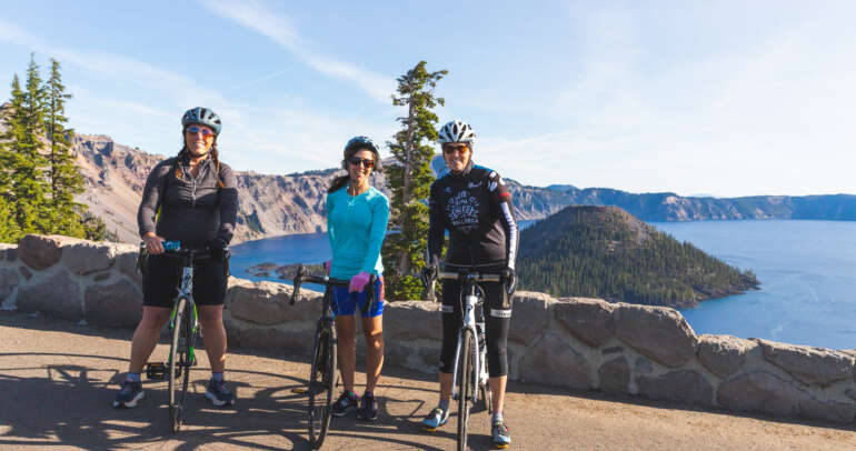
Many popular hikes originate along Rim Drive but, because of ongoing repairs to East Rim Drive, plan ahead by checking the park newspaper, “Reflections,” get updates at the Rim Village Visitor Center, visit the park’s website.
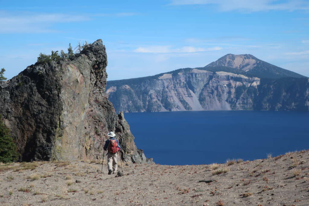
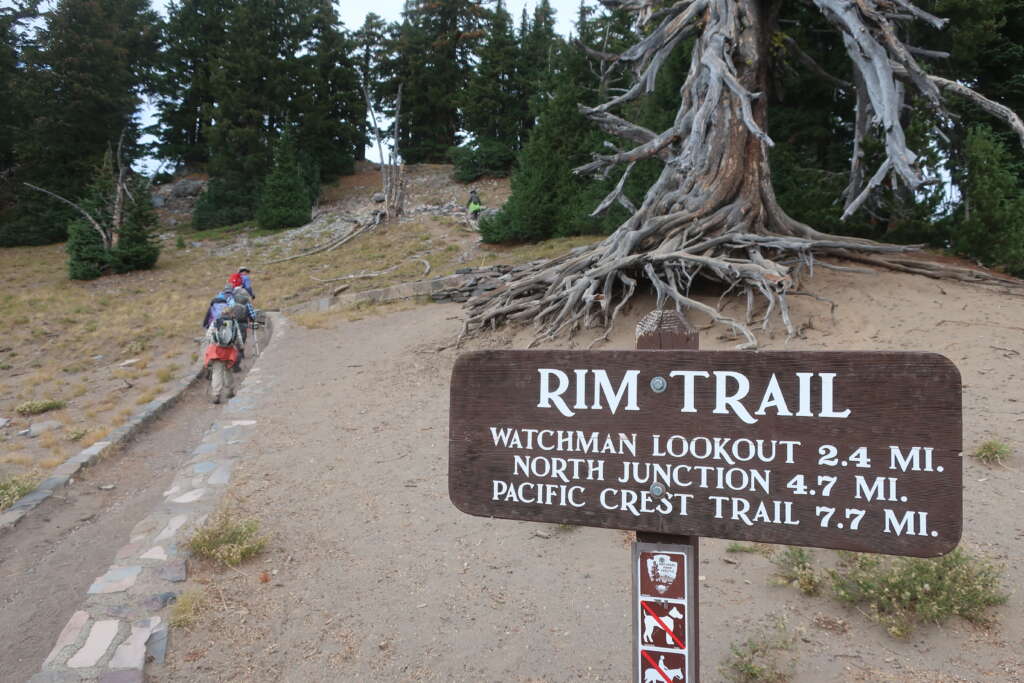
While I have no true “favorite,” always enjoyable is the Rim Trail. It can be done by hiking 6-1/2-miles from Rim Village to the North Entrance Road or in segments, ideally with a prearranged car shuttle. The Rim Trail offers seldom seen views of the lake and its steep-sloped caldera. It’s a hike to be taken slowly, partly because of its elevation – generally above 7,100-feet – and partly because there are some huff-n-puff ups and downs. But the biggest reason for taking your time are the sights.
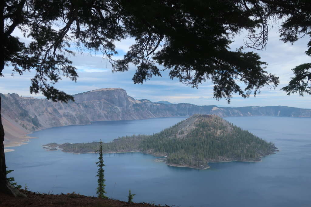
The primary sight is, of course, cerulean blue Crater Lake. The trail provides several vantages not seen from Rim Drive overlooks. Sometimes the lake and Wizard Island are framed by gnarly Whitebark pines. Other times sections of the caldera’s forbidding walls rise sharply vertical. Seen, too, are Union Peak and the massive cliffs of Llao Rock. Some views peer intimately over Wizard Island and Fumarole Bay while others reveal the raggedly serrated topography of the aptly named Devils Backbone.
It wasn’t until about 20 years ago that the Rim Trail officially became part of the Pacific Crest Trail. Illogically, the “official” PCT skirts well away from the lake, passing through a mostly uninspiring landscape. Despite the “Pacific Crest” moniker, it follows no crest but, instead, sweeps a mile and more west of the lake.
From Rim Village, the Rim Trail heads northwest paralleling Rim Drive. After a very brief section of road, the trail begins a series of climbs and dips. In a little more than a mile the trail zigzags to Discovery Point, a photo stop for most park visitors traveling in cars or vans. It’s a possible turn-around spot.
Continuing north, the trail climbs away from the crowds with more rim-edge views of the lake and its surroundings.
The trail eventually reaches another possible shuttle spot, the Lightning Spring Picnic Area. From the Rim Trail it’s a short walk to the roadside picnic area, but even better are trail-side shady spots with a lake view.
The northbound trail angles under the shoulder of The Watchman before reaching the Watchman Overlook, It’s a deservedly popular stop for hikers, bicyclists, and motorists. The “Corrals,” a rail-fenced viewing area steps from the parking lot, offers more dazzling lake viewpoints. It’s another place for a shuttle vehicle.
The Rim Trail continues up a sandy slope, veering away from the lake and around the west side of Hillman Peak while following a section of the original 1917 rim road. The lake can’t be seen, but sights include the Pumice Desert, pointy Union Peak and pyramid-shaped Mount McLoughlin. Just north of The Watchman the trail reaches its 7,740-foot high-point, but no signs mark the spot.
Because the Rim Trail mostly follows the old rim road, it transforms into an easy going, wide, nicely graded path. The ragged blades of the Devils Backbone, a volcanic dike created when magma shimmied into a vertical crack of the former Mount Mazama, appear when the trail drops towards Merriam Point and the North Junction. For a short stretch the lake remains hidden.
Hidden until – Wham! – it bursts into view as the trail descends toward the North Junction parking lot, following the lake’s knife-sharp rim. Spectacular views are abundant – Wizard Island, Llao Rock, Devils Backbone, Mount Scott, Dutton Cliff and, of course, Crater Lake.
But many other hikes feature the lake and its little-seen backcountry. The several other worthwhile possibilities include:
Cleetwood Cove
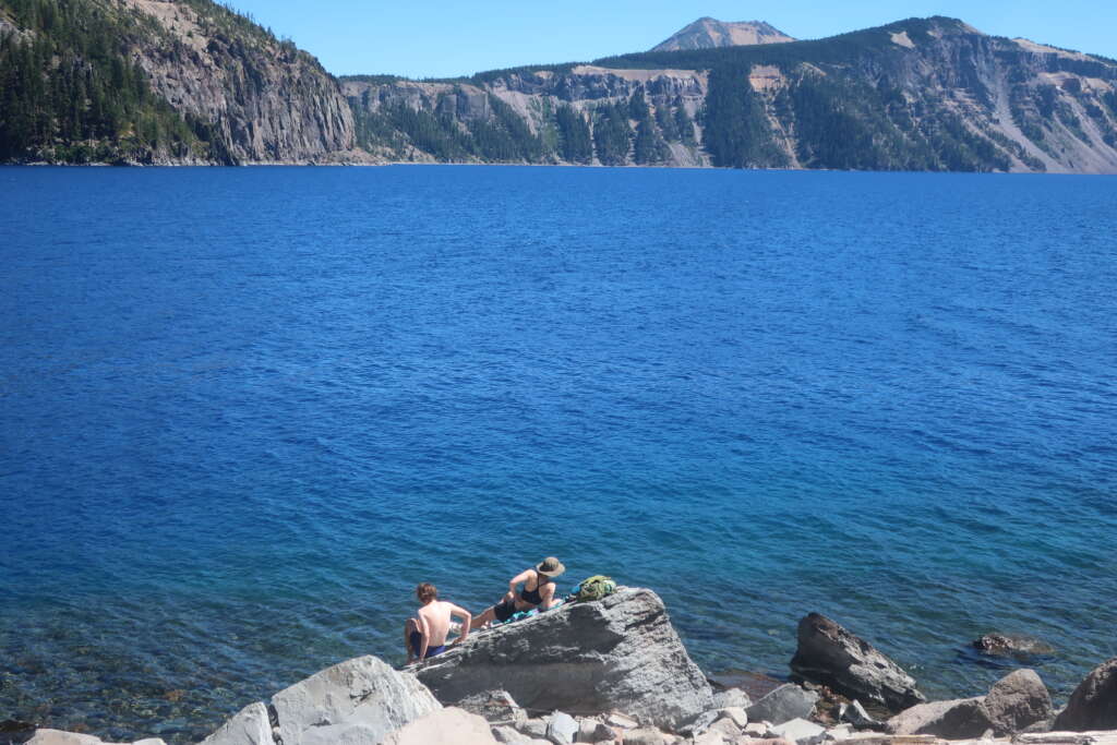
Because Cleetwood Cove Trail is the only path that reaches the lake, it’s the park’s most popular hike. The 1.1-mile-long trail drops 700 feet to the lake from the Cleetwood Cove parking lot so the walk down is easy. But the hike back up can feel like a Himalayan climb. It’s worth the effort. The lake level views will leave you with a gee-whiz appreciation for the eruptive events that turned Mount Mazama into North America’s deepest, clearest lake.
While at Cleetwood Cove consider taking a quick swim. Yes, the water can be cold, but the opportunity to swim in a caldera is unique. Swim on either side of the boat dock or a cove just up the trail past the restrooms. I like diving or jumping in from a perch above the lake. And, to make the climb out refreshing, get wet just before leaving. On the hike up, take advantage of benches to rest, drink lots of water and enjoy more lake views.
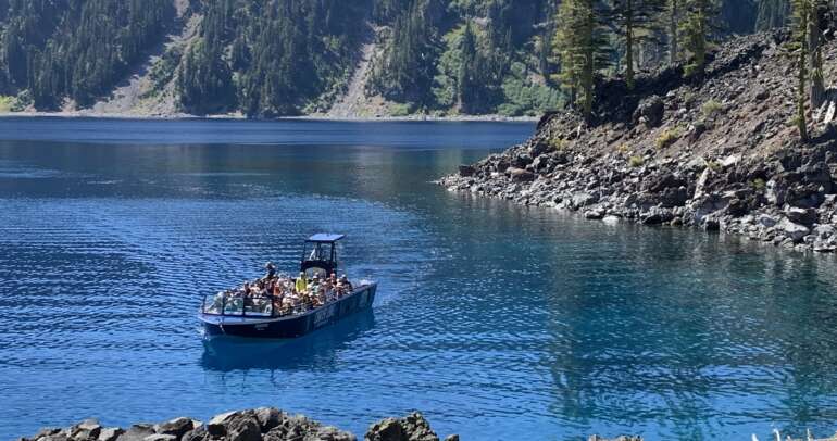
Also consider taking a lake boat tour. It’s currently uncertain when the new, quieter, larger capacity boats will begin summer operations. Tours are expected to include the standard 2-hour tour around the lake with an interpretative ranger. Offered, too, will be shuttles to and from Wizard Island, and tours that include a multi-hour layover at Wizard Island and, after being retrieved, completing the lake circuit. For updated information, and to make reservations visit the Crater Lake Hospitality or the park website.
Plaikni Falls
There’s more to the park than the lake. A family-friendly hike that’s especially popular is a mile-long, wheelchair accessible trail to Plaikni Falls. The 35-foot-high falls is named Plaikini and honors Klamath Indians, who for generations lived in and near lands included in the park. The trail crosses a pumice flat before tucking alongside rocky bluffs, where it’s common to see red-tailed hawks soaring in the thermals. Nearly a mile into the mostly gentle walk the trail angles uphill through a meadow and riparian area seasonally bursting with grasses and a rainbow’s array of wildflowers — paintbrush, Lewis monkeyflower and arrowhead groundsel. Just a short distance upstream the Plaikni Trail ends, appropriately, at the falls. The trail begins from the Pinnacles Road 1.2 miles southeast of the Phantom Ship Overlook.
Lady of the Woods
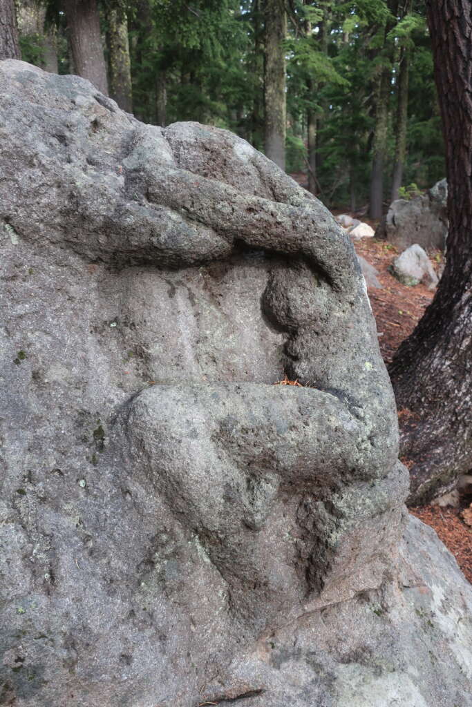
An easy trail that showcases some of the park’s historic architecture is the short Lady of the Woods Trail. The loop trail goes less than a mile from the Steel Visitor Center, which remains closed for repairs. The main attraction is “The Lady,” the sculpture of a woman carved into a boulder alongside the trail. Some people walk to the Lady then return, but it’s worthwhile to finish the loop to see many of the park’s historic buildings. A park brochure provides details about the Lady and buildings.
Sun Notch
Views of Crater Lake and the Phantom Ship are among the lures of the Sun Notch Trail. The loop trail begins along East Rim Drive 4.4 miles east of park headquarters and goes through a meadow to the lake’s rim. The U-shaped valley was carved by glaciers that eons ago flowed down from Mount Scott.
The Watchman Peak
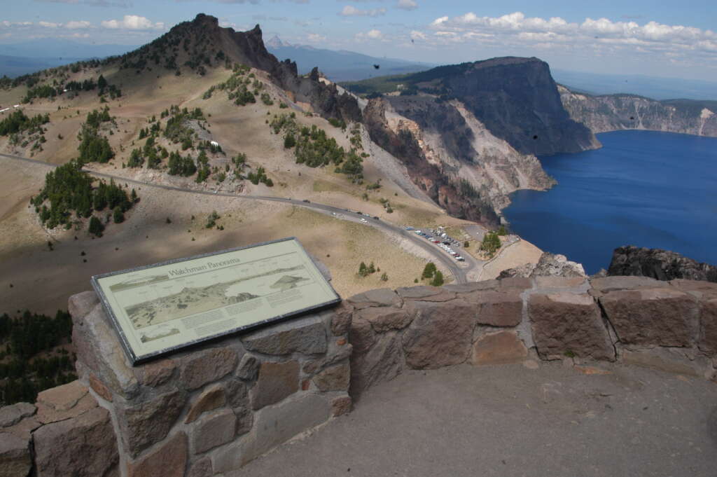
For sky-high panoramic vistas of the lake and surrounding mountains, the choice is The Watchman, which begins from the Watchman Overlook parking lot. It’s .08 of-a-mile and 656 vertical feet to The Watchman lookout. The switchback trail steadily but gradually works uphill. Once on top, check out landmarks like Mount Thielsen, Union Peak, Mount McLoughlin, Mount Scott and the Klamath Basin. The well-signed trailhead is 3.8 miles northwest of Rim Village.
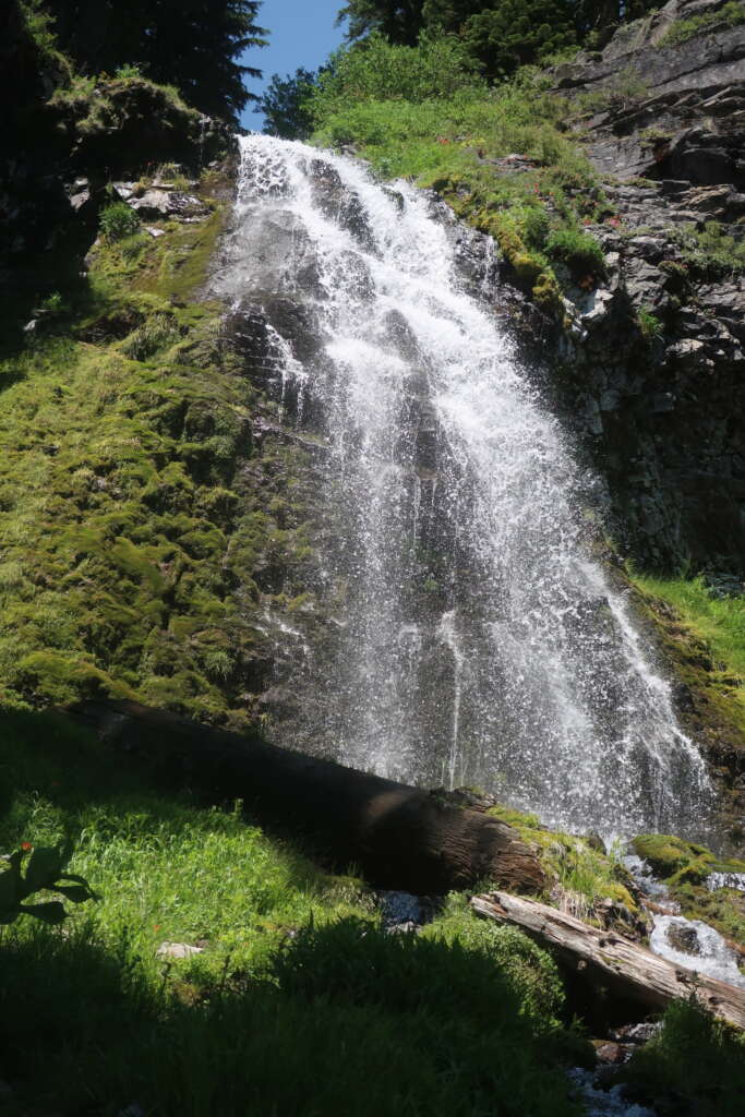
Lightning Springs
One of the park’s least traveled trails is the Lightning Spring Trail, which begins near the well-signed Lighting Spring picnic area about 3 miles from Rim Village along West Rim Drive. It’s three-quarters of a mile and an elevation loss of 250 feet to the spring, which pops from the ground and becomes a gentle creek. The hike sweeps through meadows where grazing deer and, depending on the time of year, fields of wildflowers are often seen.
Castle Crest Wildflower Garden

An easy, seasonally beautiful half-mile long trail loops around the Castle Crest Wildflower Garden. The hike begins from a trailhead off East Rim Drive a half-mile park headquarters in Munson Valley. The half-mile-long trail circles a meadow seasonally bursting with multi-varieties of paintbrush, penstemon and monkey-flowers (including the showy Lewis monkey-flower), along with red columbine, creeping phlox, pasque, shooting star and scarlet gilia.
Other Hikes
Regarded as “easy” are the Godfrey Glen and Pinnacles hikes. Discovery Point and Annie Creek are rated as “moderate” while Garfield Peak, Mount Scott and Crater Peak are longer, hilly hikes regarded as “strenuous.”
Easy or challenging, Crater Lake offers an abundance of hikes. So, if someone suggests you “take a hike,” don’t take it as something negative. At Crater Lake, take– and enjoy – a hike.
Written by Lee Juillerat in partnership with Crater Lake National Park Trust.